Traffic counting without civil works

Non-invasive traffic counting radar for vehicle counting, classification and speed monitoring 24/7

Smart traffic counting system for vehicles, bicycles, and pedestrians. Real-time traffic classification by type, lane, and direction, with speed measurement, no camera, no civil works, and traffic data integration via CSV, REST API, MODBUS, or uRAD Cloud.

Deployed by the Pamplona City Council — 8 radars and 2.7M annual passages monitored.

Response within 24–48 h with recommended model, installation requirements, integration options and estimated timeline.
No civil works Up to 4 lanes Camera-free traffic monitoring API REST · MODBUS · uRAD Cloud >95% accuracy with correct installation
uRAD Smart Traffic counting radar — non-invasive traffic counting sensor.
Is it the right fit?

Is uRAD Smart Traffic the right solution for your project?

Quickly understand whether it fits your use case. A non-intrusive traffic counter for urban and interurban infrastructure — not a speed enforcement system and not video analytics.

Tráfico urbano vista cenital — infraestructura existente lista para aforador no invasivo
Existing infrastructure. No civil works. No cameras. Image for illustrative purposes
!

Inductive loops and pneumatic tubes require civil works, road closures and maintenance.

!

Cameras depend on lighting, weather and privacy requirements — performance may degrade in rain, fog or low-light conditions.

uRAD is a non-intrusive radar-based traffic counter : 24/7 monitoring, no civil works and structured data ready for integration.

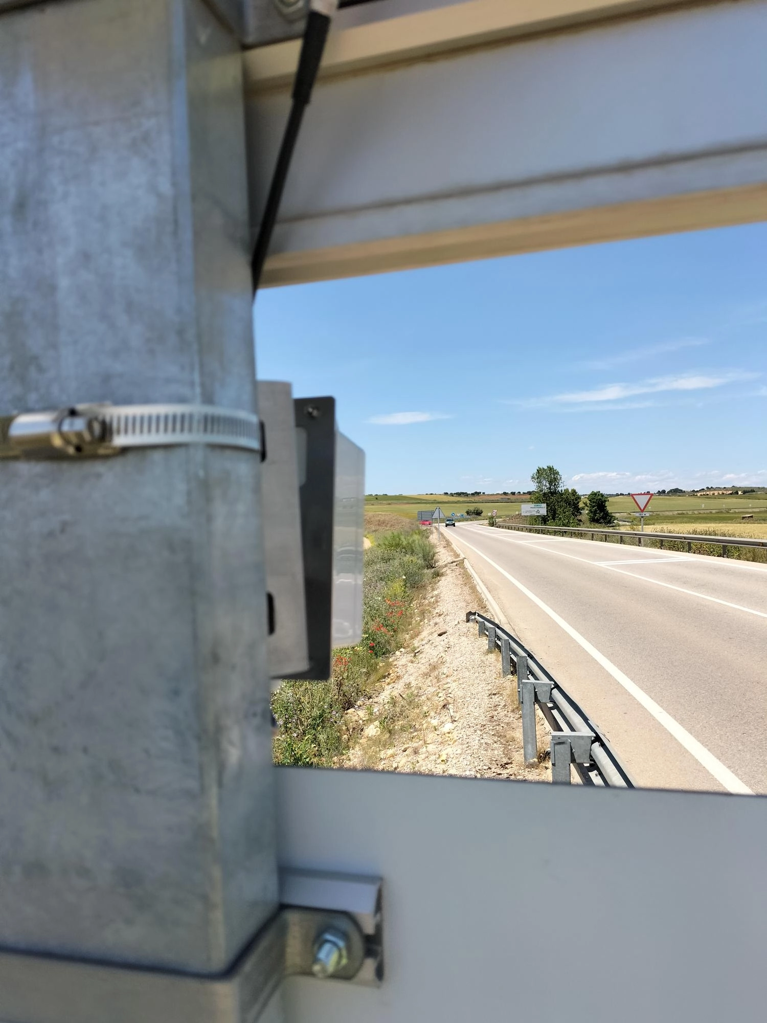
Best fit if you need

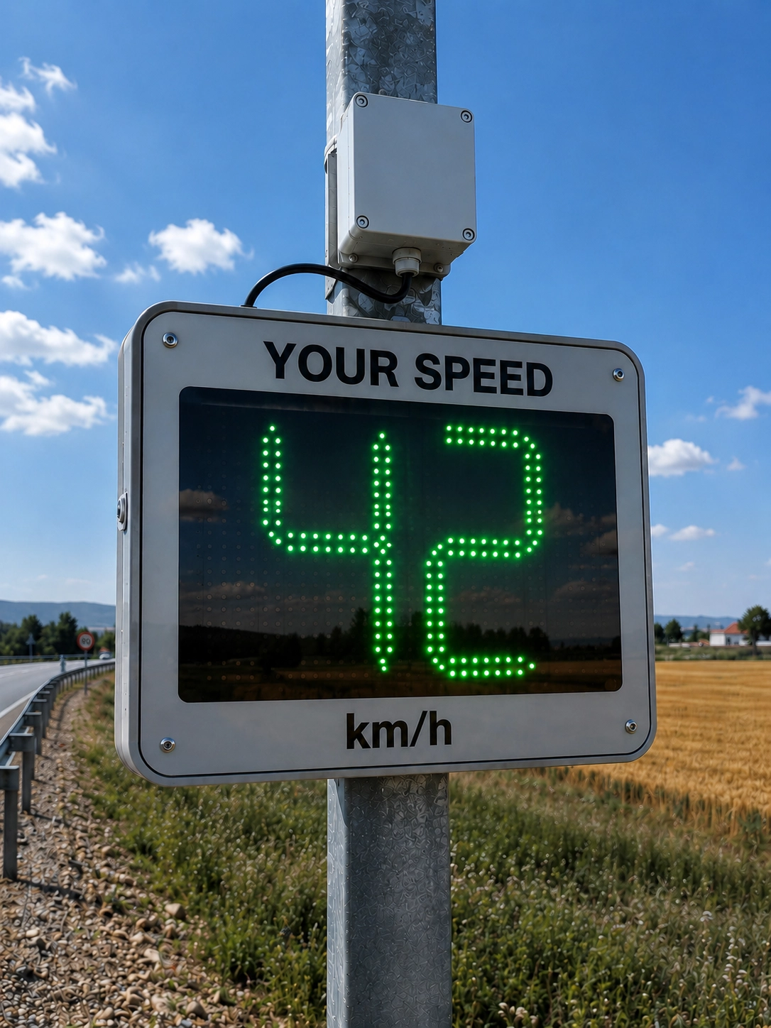
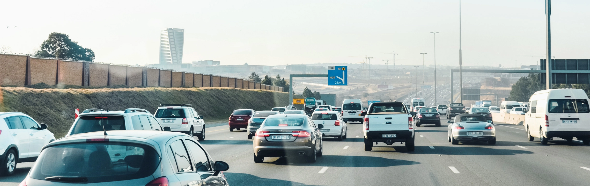
  • 24/7 traffic counting without civil works, using existing infrastructure.
  • Data by lane, direction, class and speed
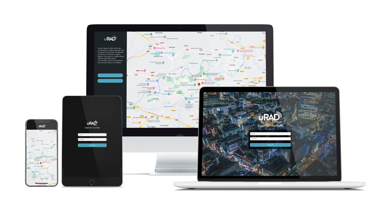
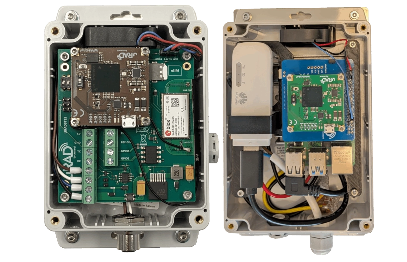
  • Integration with a municipal platform, ITS, or control center
  • Deployment: deployment (studies) or permanent
  • Counting of bicycles and pedestrians in addition to vehicles

Not the best fit if you need

  • License plate recognition / LPR / OCR.
  • Automatic speed enforcement or ticketing.
  • Video analytics with visual identification of people
  • Incident detection with image capture.
  • A minimum-cost counter with no integration requirements

uRAD compared with cameras, loops, tubes and other traffic sensors

Use cases

Where uRAD Smart Traffic is deployed

Each use case answers a project decision: where to install, which model to choose, what data to collect and how to integrate it.

Aforo de vehículos Pamplona Municipalities · Urban mobility

Vehicle counting and classification on urban roads

Continuous lane-by-lane traffic counts, heavy vehicle distribution and real-world speeds on main streets and avenues.

Decision supported: identify which streets require traffic calming or lane redesign.

Ingeniería de movilidad Transport engineering firms

Temporary mobility studies

Fast deployment without civil works for traffic studies, before/after analysis and technical assessments.

Decision supported: measure the real impact of a traffic intervention.

ITS integration ITS integrators · Traffic platforms

Integration with traffic platforms

Data delivered through API or MODBUS to control centers, ITS systems and mobility platforms.

Decision supported: add radar-based counting without rebuilding the client’s backend.

Success story · Smart City
Pamplona City Council
Go Green strategy · municipal cycling network
Year 1 2022–23

Pamplona counts 2.7 million bicycle passages per year with uRAD

Eight uRAD Smart Traffic radars monitor the city’s cycling network — without civil works, without cameras and with data integrated into the municipal platform.

2,7MPassages per year+7,492 bicycles/day
8Radars deployedCovering the network
18,8km/h Average Speed25,9 máx Labrit
20,5%Wrong-way trafficDetected at Pío XII

The counters enable non-intrusive monitoring with very high accuracy and can even identify cyclists travelling in the wrong direction — 20,5% at Pío XII.

Pamplona City Council May 2023
What this case proves
Proven operation in a real urban environment, with 8 continuous monitoring points.
Multi-point deployment without civil works or road closures.
Use by a public administration with auditable and reportable data.
Continuous data generation for mobility decisions — not just one-off counts.
Inventeers

Also validated beyond road traffic: Inventeers in the Netherlands uses uRAD to count boats on inland waterways — Grip op Water project.

View project ↗
Accuracy and conditions

+95% accuracy — with correct installation

We validate the setup before deployment to ensure accurate results on your road.

>95% Vehicle counting accuracy With correct installation and orientation

In correctly oriented installations, the system achieves more than 95% counting and classification accuracy. Performance is stable for 24/7 monitoring and does not depend on lighting conditions.

Real-world accuracy depends on mounting height, angle, lane width, road geometry and occlusions. Our team reviews each use case and recommends the configuration before deployment.

Mounting height and pole angle
Lane width and number of lanes
Dense or light traffic
Curves and occlusions
Radar uRAD operando bajo lluvia — medición continua 24/7 sin degradación por condiciones climáticas
Night Rain Fog
Continuous operation

Where cameras lose accuracy in low light, rain or fog, radar maintains counting accuracy day and night.

IP66 · −20 °C to +80 °C
Capabilities

What it measures and how data is delivered

A single installation covers traffic capture, classification, and data integration. Data is delivered via REST API or MODBUS — either to the uRAD Cloud platform or directly to your own system.

What the radar measures

Detection and classification
  • Vehicle counting 24/7CSV
  • Classification · regular, medium, long, bicycle, pedestrian5 classes
  • Speed 0–180 km/h±1 km/h
  • Lane-by-lane analysis up to 4 lanesBi-directional
  • Direction approaching and receding traffic simultaneouslybi-dir

How data is delivered

Output and integration
  • CSV export · event-by-event with timestampBI-ready
  • REST API documented for your systemJSON
  • MODBUS RS-485 for PLC / control centerRTU
  • uRAD Cloud · AWS-based SaaS dashboardoptional
  • Local storage Local storage on RPi · full onboard historyRPi model
uRAD Cloud Platform

Or use it as a turnkey AWS-based platform

If you do not want to build your own dashboard, connect the radars to uRAD Cloud and get real-time statistics, report downloads and multi-sensor monitoring from your browser.

  • AADT, average speed, percentiles and lane occupancy
  • CSV or PDF reports for audits and technical documentation
  • Multi-sensor monitoring from a single console
Request a uRAD Cloud demo →
uRAD Cloud dashboard platform
Available models

Two configurations for two types of project

Same 60–64 GHz radar core, available in two versions. Choose the best fit for your deployment’s connectivity and integration needs.

★ Most popular
uRAD Smart Traffic Compact
Direct integration uRAD Smart Traffic

Compact

2,5 W mín. MODBUS RS-485 WiFi · 4G · LoRaWAN opc. Batería externa opc.

A closed and compact sensor with native MODBUS RS-485 and with optional connectivity as required: WiFi, LTE/4G, or LoRaWAN connectivity options. Connect to uRAD Cloud or to your own system via REST API.

Recommended for
  • Counting and classification in locations with simple installation requirements
  • Direct OEM integration via MODBUS or REST API
  • Deployments where advanced local processing is not required
  • Temporary studies with external battery power (optional purchase or rental)
Avoid if
  • You need more flexible local processing
  • You require custom logic running on the device itself
Check if Compact fits my road
uRAD Smart Traffic RPi
Configurable projects uRAD Smart Traffic

RPi model

Local storage Modifiable code Linux + RPi Built-in WiFi + 4G Batería externa opc.

Processing processing with high-capacity internal storage: saves the full traffic history directly on the device, without relying on a continuous connection. Code access so the developer can integrate detection and send the data to their own platform in whichever way they prefer.

Recommended for
  • Projects with more complex integration and built-in 4G connectivity.
  • Deployments with full historical data stored on the radar device itself
  • Locations with intermittent coverage — data is not lost even if the network goes down.
  • Technical teams that need to access and modify the code o integrate detection their own way.
  • Temporary studies with external battery power (optional purchase or rental)
Avoid if
  • You only need basic counting — Compact may be enough
  • No local processing or custom logic required
Request advice on RPi

Not sure which model to choose?

Send us the installation point and your measurement goal — we will recommend the right model, configuration and integration options.

Recommend my model →
Technical comparison

Feature-by-feature comparison

FeatureCompactRPi model
ProcessorXtensa dual-core · 240 MHzRaspberry Pi · ARM Cortex-A72 · 2 GB
Power supply8–42 V DC8–40 V DC
Power consumption2,5 W4,5 W
CommunicationMODBUS RS-485 · WiFi / 4G / LoRaWAN opc.WiFi · 4G nativo · API REST
Local storageBasic internal bufferFull onboard history · expanded capacity
Customizable codeClosed firmwareCode access · custom integration
External batteryOptional · purchase or rentalOptional · purchase or rental
Dimensions115 × 90 × 65 mm171 × 121 × 80 mm
Weight560 g1,1 kg
Data deliveryuRAD Cloud platform (AWS) · or · your platform via REST API / MODBUS
Before you buy

What you receive before making a decision

We review your road layout and provide a specific technical recommendation — so you know what to request, why it fits and what risks to consider.

Técnico de campo revisando proyecto — recomendación técnica antes del despliegue
Pre-deployment step Before preparing a quote, we validate your road setup No obligation · response within 24–48 hours

Technical review of your road

We assess lanes, traffic direction, available mounting height, power supply, communications and measurement goals. If something does not fit, we tell you before quoting.

Recommended model

We tell you whether Compact o RPi según conectividad, integración, alimentación y entorno — no al revés.

Integration plan

We define whether you need CSV, API REST, MODBUS, uRAD Cloud or integration with your existing municipal or ITS platform.

Quote and timeline

You receive a proposal based on number of points, accessories, installation and integration, with estimated manufacturing and delivery times.

You do not need to know which model to choose: send us the approximate location and measurement goal — we recommend the configuration.

Request a technical recommendation →
Technical documentation

Download uRAD Smart Traffic technical documentation

Freely access datasheets and user manuals for each model to review specifications, installation, configuration and integration before requesting a technical recommendation.

Autopista radar uRAD
  • Datasheet by model with electrical and mechanical specifications
  • User manual with installation and integration guide
  • Documentation ready for reports tenders and technical comparisons

Need a technical specification, tender support or integration examples for your project? We prepare it together with the technical recommendation.

Request a technical recommendation →
How much does a uRAD Smart Traffic counting radar cost?

The price depends on the model, number of measurement points, connectivity, power supply, accessories, installation and integration. We do not publish a fixed price because each deployment is different. Send us your road details and we will provide a quote within 24–48 h.

What do you need to check whether my road is compatible?

Number of lanes, traffic direction, possible mounting location, available height, power supply, communications and measurement objective. With that information, we can confirm whether the site fits before quoting.

Can one radar count multiple lanes?

Yes. Up to 4 lanes with one radar , depending on configuration and installation. The exact coverage depends on mounting height and road geometry.

Can it classify different types of vehicles?

Yes. Classification can include regular vehicles, medium vehicles, long vehicles, bicycles and pedestrians. Classification granularity and accuracy depend on configuration and site conditions.

Does it measure speed?

Yes. In addition to counting and classification, it measures vehicle speed from 0 to 180 km/h with ±1 km/h resolution.

Does it work without cameras?

Yes. It is radar-based, not camera-based. It does not capture identifiable images of people or license plates, making it easier to deploy in privacy-sensitive environments.

Can it integrate with Smart City platforms?

Yes. Data can be delivered through API REST, MODBUS RS-485, CSV or direct connection to the uRAD Cloud platform. It is compatible with municipal platforms and existing control centers.

Is it suitable for public tenders?

Yes. We can provide technical documentation to support public procurement, technical specifications and solution comparisons.: including datasheets, installation requirements, integration options and real-world use cases such as Pamplona

Sales and technical contact

Tell us about your
traffic counting project

We help you choose the right traffic counting radar based on road layout, number of lanes, connectivity, power supply and data integration requirements.

  • Technical model recommendation: Compact / RPi
  • REST API / MODBUS integration plan with your platform.
  • Project quote and estimated delivery or deployment timeline.
  • Access to a uRAD Cloud dashboard demo upon request.

    Technical recommendation

    Tell us about your project


    Technical response within 24–48 hours. Recommended model, integration plan and indicative budget.


    No spam. We’ll only use your details to respond to your enquiry.